
The power of data in imaging is transformative and has become a must-have advantage to government and enterprise alike
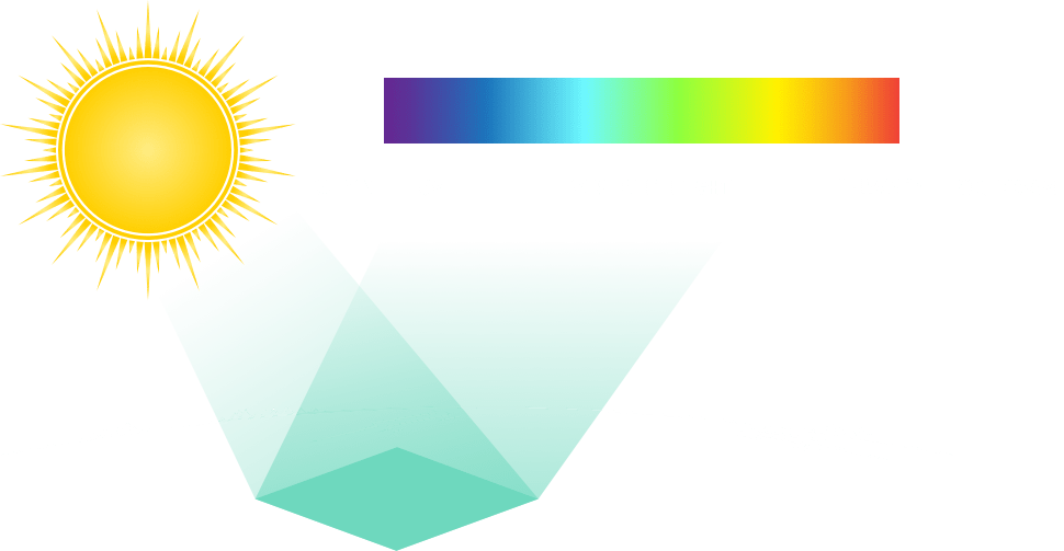
The goal of hyperspectral imaging is to obtain the spectrum for each pixel in the image of a scene, with the purpose of finding objects, identifying materials, or detecting processes. Hyperspectral imaging is a quantum leap in imaging data analysis beyond the limitations of panchromatic and multispectral imaging alternatives. A space-based hyperspectral imaging system has the additional advantages of unfettered global coverage with repeat view and change detection capabilities.
What is it possible to know about our planet that we don’t already know?
We will soon have a staggering amount of new information at our fingertips.
Tools are already available to us to see beyond what lies in plain sight. Imaging data can tell us a great deal about the air, the soil, vegetation, moisture, minerals and gasses. We can even discern chemical composition, be it naturally occurring or man-made. So far, we’ve had only an unreliable patchwork of information stitched together from aircraft and satellite imagery with narrow fields, limited capabilities, restricted access and variable resolution.
Not for long.
Our new technology will provide a clear picture of the entire surface of the Earth with greater resolution and a wider dataset than ever before — and track how it all changes over time.
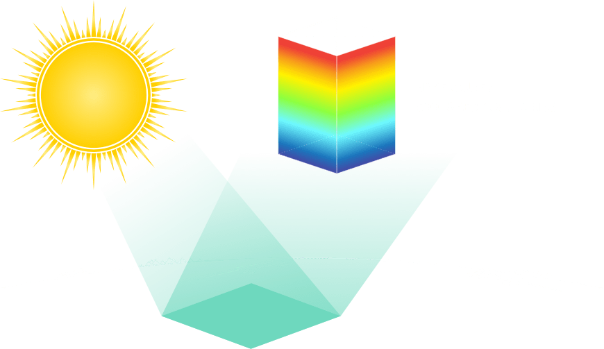
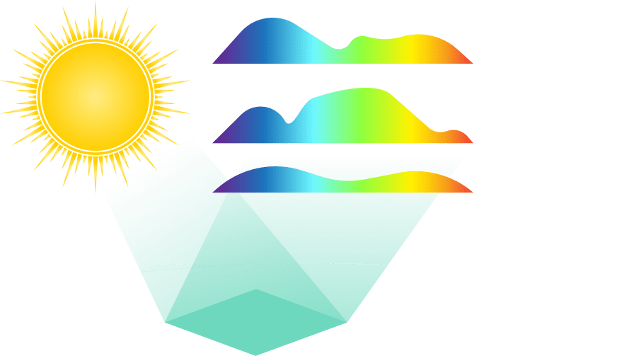
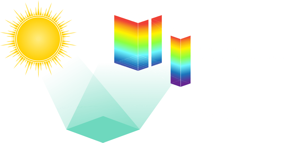
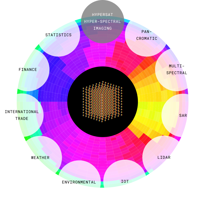
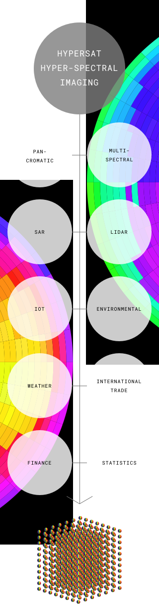
THE HYPERCUBE
Capturing high value data


A historically close view
What if the entire Earth could be broken down into small squares and meticulously studied? What if we could see every square meter of land, water and ice on the planet’s surface? What if we could see how they change over time?
If we could only see close enough, it would change everything.
That’s exactly what Hypersat has set out to do. When we reach our objective, a truly incredible 510 billion square meters of earth will be captured, catalogued and prepped for continuous analysis.
That’s billions of 3.5m2 images packed with 500 different spectral views — the most ever captured of Earth in satellite imagery. And every single square will be scanned repeatedly over time and at an unprecedented resolution. And we go one level deeper still.
Data
The detail of the data is everything
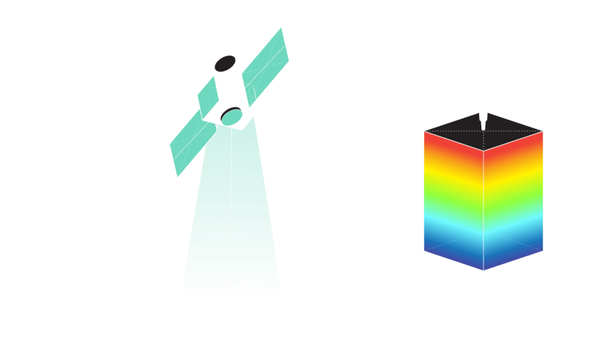
Hypersat satellite
Advantages:
- High spatial resolution
- Highest spectral resolution
- Global coverage
- Continuous imaging
- Rapid order fulfillment
- Low cost solution
Resolution:
- 6m X 9m + sub-pixel data
- 500 bands
Transforming raw data into insight
With Hypercubes delivering a completely new type of dataset, we need a completely new way to analyse and interact with the massive store of information and harvest valuable insights at the right time. Advances in both science and technology are required.
Hypersat recruits top scientists, engineers and analysts to research and develop innovative approaches and solutions to help realise the full potential of this new data stream — and deliver maximum impact to the world.
Our core technical approaches
Creating Metadata Hypercubes
Hypersat will create Metadata Hypercubes by fusing imagery with publicly and commercially available remote sensing data as well as other relevant data feeds.
Who will this benefit?
Access to Hypercube data can lead to industry-transforming insights. It can deliver an enormous advantage to any organisation that stands to benefit from knowledge of what is happening on the surface of the planet, whether in its pristine geological state or as the result of human activity or natural phenomena over time.
Actionable information on this scale can fundamentally change decision-making, help us optimise operations, and allow us to better manage all manner of resources — all around the globe. Here are a few verticals that might benefit greatly.
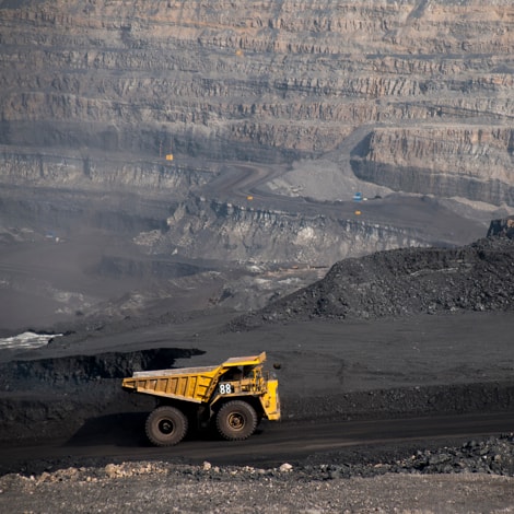
Resource extraction
Imagine being able to find new ways to locate and access resources more efficiently, economically and sustainably.
Hypersat data can help optimise every stage of extraction, from assessing mineral concentrations and defining orebodies to accelerate exploration to monitoring assets and observing surface operations around the globe. It can help you assess, select, plan, develop, secure, decommission and restore sites. And it can help mitigate environmental impacts and enable sustainable mining practices for the benefit of us all.

Agriculture
As world populations continue to grow, we need to evolve how we think about and produce food. Hypersat data can drive significant improvements in overall yields, quality and profitability of agricultural operations.
Deeper data offers a better way to measure soil composition, moisture, nitrogen, temperature and more to help optimise operations throughout the growing cycle. It can enable you to identify not only crop cover, but also weeds and pests. It will help us study the impact of climate change, weather patterns, and desertification. It can inform insurance assessments and add efficiencies to the business of agriculture.

Climate science
Widely acknowledged as the greatest challenge facing our species, Hypersat data can help us understand and better respond to climate change.
It will give us a more accurate picture by measuring biodiversity, moisture and desertification, pollution levels and more. It will help us study the impact of urbanisation and human activity on natural habitats and on the health and productivity of people and species. And it will help us to understand, anticipate, respond to and mitigate against hazards and natural disasters.

Defence and intelligence
Hypersat data can provide governments and militaries with an important advantage to help safeguard people, assets and communities.
One important capability is adding visibility in situations where it was difficult or impossible in the past. It can help you locate, characterise and verify previously undetectable or camouflaged targets based on material composition. And it can help pinpoint danger points by identifying signature residues at weapons manufacturing and testing sites or monitoring disturbed earth to locate underground facilities and IEDs.
The possibilities are astonishing — and endless
Access to Metadata Hypercube data and insights derived from it are going to help thinkers and innovators around the world answer some really important real-world questions and find solutions for some of our biggest, most fundamental challenges — including many we have not even conceived of yet. That is truly powerful data.
Imagine having answers to scientific questions like these:
- What is the composition of exposed terrestrial surface of the Earth?
- How does it respond to anthropogenic and non-anthropogenic drivers?
- How can measurements of rock and soil composition be used to understand and mitigate hazards?
- What impact do desert dust and black carbon have on critical water resources through the acceleration of snow and glacier melt?
- What are the extent and impact of invasive species in terrestrial and aquatic ecosystems? And what are the economic and human health consequences?
- What is the spatial structure and species distribution in a phytoplankton blooms?
- How do patterns of disturbance vary and change over time within and across ecosystem?
- How can we better manage living marine and other aquatic resources?
- How do change in ecosystem composition and function affect the spread of infectious diseases and the organisms that transmit them?
- How do changes in ecosystem composition and function correlate with geographic patterns of conflict or economic and political stress?
- What are the consequences of uses of land and coastal systems, such as urbanization and resource extraction, for the carbon cycle, nutrient fluxes and biodiversity?
And that’s just a sample. There are truly no limits to what this data can help us understand and achieve.
Meet the team
Derek Woods
Chief Executive OfficerWith over 25 years of business leadership and board experience, in both public and private companies, Mr. Woods has a combination of operating, finance and transaction experience, focused on the satellite sector. Prior to founding Hypersat, Mr. Woods was the Managing Director/President of ARTEL, a major provider of managed satellite and terrestrial communications networks primarily to the US government and military.
With over 25 years of business leadership and board experience, in both public and private companies, Derek Woods has a combination of operating, finance and transaction experience, focused on the satellite sector.
Prior to founding Hypersat, Mr. Woods was the Managing Director/President of ARTEL, a major provider of managed satellite and terrestrial communications networks primarily to the US Government and military. As MD at ARTEL, Mr. Woods increased revenues from $300mm to $450mm. Headquartered in Virginia, ARTEL had operations and infrastructure around the globe.
Previously, Mr. Woods was the CEO of Stratos Global Corporation, a satellite communications company, now part of Inmarsat. Mr. Woods, over five years, grew the company from a private start-up to a public company with revenues in excess of $500mm. At that time Stratos was the largest global distributor of Inmarsat, Iridium, MSAT and Globalstar services, as well as the largest provider of VSAT services to the offshore oil and gas industry.
Prior to Stratos, Mr. Woods was a partner in the law firm of Stikeman Elliott LLP, practicing securities law for clients that included Bell Canada, Teleglobe, Merrill Lynch, Morgan Stanley and RBC Dominion Securities. Mr. Woods practiced and is called to the bar in New York, Massachusetts, Ontario and Manitoba; he also practiced and is qualified as a solicitor in the United Kingdom, Wales and Hong Kong.
Mr. Woods obtained his Bachelor of Arts and Juris Doctor/Bachelor of Laws degrees at the University of Manitoba. This was followed by a Master of Laws in International Finance at the London School of Economics and a Master of Business Administration (Honors) from the Graduate School of Business at the University of Chicago. Mr. Woods has served on the boards of Inmarsat, Stratos, Artel, and the Satellite Industry Association.
Read full bioColin Hutchinson
Chief Financial OfficerMr. Hutchinson has more than 20 years of experience in finance across a global auditing firm (Deloitte), a large publicly traded company (Vodafone Group), and other billion-plus companies within the telecom and natural resource sectors. Mr. Hutchinson was the CEO of Ascent Resources, a London listed oil & gas company.
Mr. Hutchinson has more than 20 years of experience in finance across a global auditing firm (Deloitte), a large publicly traded company (Vodafone Group), and other billion-plus companies within the telecom and natural resource sectors. Mr. Hutchinson was the CEO of Ascent Resources, a London listed Oil & Gas company. He helped bring the project from conception to ultimately a £50 million market cap company. Other leadership positions of note include Chief Commercial Officer for Digicel, a mobile telecoms operator across Caribbean & Central America with $1 billion in annual revenue, and Chief Financial Officer of Airnow plc, a London listed SAAS business. He holds a Bachelor of Law degree from the University of Dundee, and a Master’s in Business Administration from Warwick Business School. He is a Chartered Accountant (FCA).
Read full bioNils Helle
Chief Operating OfficerMr. Helle is a 25-year satellite industry veteran with experience in integration, strategic growth, inter-company initiatives, customer service, and market communications. As Chief of Staff with EMS Technologies, he was instrumental in developing and executing the strategy that led to increased shareholder value and ultimately the sale of EMS to Honeywell for $500 million.
Mr. Helle is a 25-year satellite industry veteran with experience in integration, strategic growth, inter-company initiatives, customer service, and market communications. As Chief of Staff with EMS Technologies, he was instrumental in developing and executing the strategy that led to increased shareholder value and ultimately the sale of EMS to Honeywell for $500 million. Since 2011 Mr. Helle has worked as an independent consultant. Clients include Honeywell, Hypersat, Inmarsat, Cobham, Astrium, Comdev, Kymeta, FLYHT, and Square Peg Communications. Mr. Helle has attended executive education programs at Richard Ivy School of Business, London, Ontario, and at Stanford University, California.
Read full bioMichelle Truly
Chief Strategy OfficerMs. Truly has 35 years of experience in the space, defense and intelligence markets. Her career began at NASA Johnson Spaceflight Center working in Human Spaceflight Mission Operations where she participated in astronaut and flight controller training for a variety of missions from deploying communications satellites to remote sensing missions such as the Shuttle Radar Topography Mission.
Ms. Truly has 35 years of experience in the space, defense and intelligence markets. Her career began at NASA Johnson Spaceflight Center working in Human Spaceflight Mission Operations where she participated in astronaut and flight controller training for a variety of missions from deploying communications satellites to remote sensing missions such as the Shuttle Radar Topography Mission. This experience led to roles at Army Space Command and The Boeing Company in strategic planning and business development. Ms. Truly has a Mechanical Engineering degree from Tufts University.
Read full bioGet in touch
What Hypersat is trying to achieve is technologically and logistically complex. If you would like further information or clarifications, our experts are standing by to answer your enquiries.